
With the newest release of the European Atlas of the Seas today, citizens from all around Europe now have access to stunning marine maps and interactive oceanic information in their own language, making the Atlas an even more accessible and useful educational tool. From now on, visitors can navigate the Atlas in the 24 official languages of the European Union, as well as explore a wide range of popular marine topics, such as tourism, litter, environment, energy, aquaculture, and much more!
With an enriched catalogue of more than 285 interactive map layers and the possibility to create custom maps that can be printed, shared and embedded in articles or presentations, the European Atlas of the Seas is the easy and attractive way to connect people to our blue planet.
Protecting the ocean, and using our marine resources sustainably, starts with knowledge and understanding. The European Atlas of the Seas helps to improve the ‘ocean literacy’ of us all. Thanks to its availability in all official EU languages, the Atlas will finally become an indispensable resource not only for professionals, but also for educators and students all across Europe, to better understand the importance of oceans and take the right decisions to save them
Virginijus Sinkevičius, EU Commissioner for Environment, Oceans and Fisheries
The Atlas comes with a range of new features (available from 16 September 2020), including easier ways to print maps, an improved measurement tool, the integration of short stories highlighting interesting map layers and the use of the most detailed background map available worldwide, provided by EMODnet. An interactive help function now guides visitors through these new features of the Atlas.
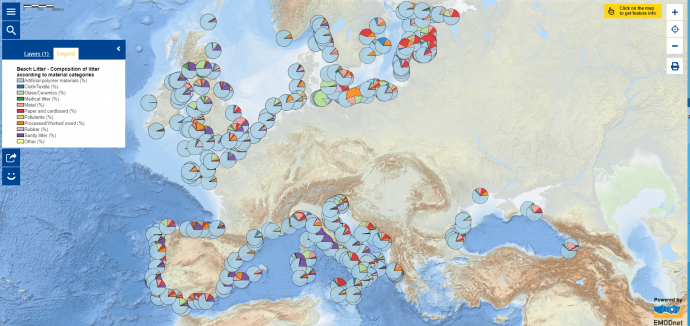
What kind of litter ends up on European beaches? What is the most prevalent type of waste in your country? Does it concentrate in particular areas? The European Atlas of the Seas provides all the answers in a single map!
24 reasons to learn about the ocean
Following the release of the multilingual Atlas, the campaign “24 reasons to learn about the ocean” will feature well-known public figures from around the European Union, highlighting in their own language what the ocean means to them and why you should #ExploreYourOcean!
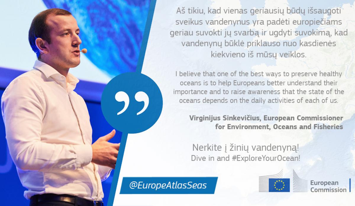
Commissioner Sinkevičius is launching the campaign with a quote in Lithuanian. Stay tuned on Twitter and Instagram with the hashtags #ExploreYourOcean and #EU4Ocean!
The Atlas is definitely worth a visit! http://www.european-atlas-of-the-seas.eu/
About the European Atlas of the Seas
The European Atlas of the Seas is the official digital mapping tool of the European Commission’s DirectorateGeneral for Maritime Affairs and Fisheries dedicated to ocean literacy. It is an interactive and educational webmapping application to explore and understand Europe’s seas and coasts. The Atlas is an Open Data platform and benefits from the important contributions of many data providers. These are primarily the European Commission and its agencies (European Environment Agency, Eurostat,…), as well as EMODnet, which itself provides about 135 maps. Since September 2017, the EMODnet Secretariat managed by Seascape Belgium has taken over the management of the Atlas and released a revamped version in 2018, with a vision to amplify the visibility of this exciting and valuable resource.
Download the full press release in PDF


